
PLEASE NOTE: Construction is currently underway in the Park and as such the course is no longer functional – the park has been completely shredded (building a canal for the river etc). We’ll let you know when the construction has been completed.
We’ve placed a permanent orienteering course in a small Bedfordview park, Oriel Park. Oriel Park is located on Kloof Road one block West of the N3 highway (see map below).
Who can participate?
EVERYONE! Oriel Park is the most fabulous little park that many local residents have never set foot on. Walk from home, with your child/ren and partner, and give this family-friendly activity a try. Orienteering is a bit like Easter-egg hunting, only we tell you where the ‘eggs’ are located – you just have to find them!
How to get a copy of the map
- Download the colour PDF file (168kb) and print on your colour printer (or take the file to a local copy shop for them to print it for you). Please do not print the colour map on a black-only printer – the detail and features are very obscured.
- Visit the friendly PostNet store in Bedford Centre (upper level near the banks). They’ve got the map on their computer and they’ll print you a copy. The colour A4 page is R8.00.
Directions to Oriel Park
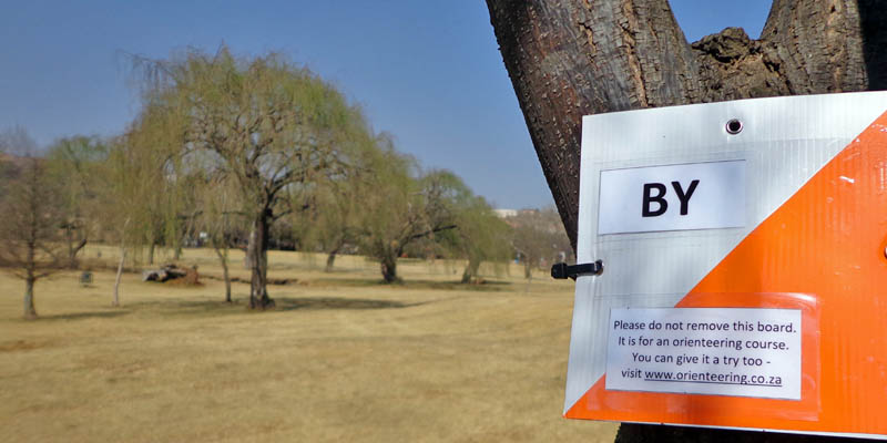
The start of the orienteering course is near the corner of Kloof Road and Lynwood Roads in Oriel, Bedfordview. The start-finish location (triangle and double circle) is across from the guard house – look for the orange and white board on the tree. See road map below.
Orienteering basics
 Once you’ve got your map, you’re halfway there.
- Get to the start and stand next to the start tree, looking ‘into’ the park.
- Turn your map so that it is orientated correctly. Look for Kloof Road on the map (near the ‘bottom’) and turn your map so that Kloof Road is on your right and the river is in front of you.
- Now, you’re at the start (triangle). Keeping your map orientated, look in the direction of the first control location, which is numbered ‘1’.
- Tell yourself a story about what you expect to see on the way to #1. Remember to look at the legend on the right-hand-side of the map and consult the code blocks on the left for a clue about the feature.
- My story would be: “Go past the bunch of trees (light green patch) and head towards a foresty looking area (white patch) where I expect to see three quite big trees (green outline circles). I’ll first cross over the path (dotted black line) before I get to the trees and the tree I want is to the left of some kind of marsh/water canal thing”. Look for the board on the tree when you get there.
- On the board will be a two-letter code. Write this code in the block for #1.
- And that’s how you orienteer! Keep going like this around the course from 1 to 2 to 3 etc. You must go in number order. The finish is the same as the start and it is indicated by a double circle.
- Send an email to lisa@ar.co.za and she’ll send you the correct answers.
Hhhheeelllppp please!
Check back here for dates and times of when Lisa will be at Oriel Park to assist you (week-day evenings and weekend mornings). School groups will be gladly assisted by arrangement. Please contact Lisa – lisa@ar.co.za
Thank you
Many thanks to local DA councillor Michele Clarke who passed Lisa’s permission request on to the right people at Ekurhuleni Metro and to GS van der Merwe, Regional Manager of Metro Parks, for granting permission for this community activity.

What a wonderful way to get the residents back in the park, at one stage I was very worried that some developer would take it over.
Pingback: Orienteering on 702 Green Tip :